Fast Limnological Automated Measurements - 'the FLAMe'
|
The FLAMe is a mobile sampling platform designed to measure surface conditions across individual rivers and lakes. We leverage traditional sensor technology with a global positioning system (GPS) to produce high resolution maps of surface water chemistry. Using these maps, we can identify point source locations, infer processing rates, and produce distributions of surface water conditions. All of which lead to an improved understanding of our lakes and rivers. This project was funded by the University of Wisconsin - Madison and U.S. Geological Survey.
|
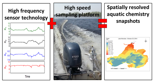
Top: Image taken from - Crawford, Loken et al. 2015
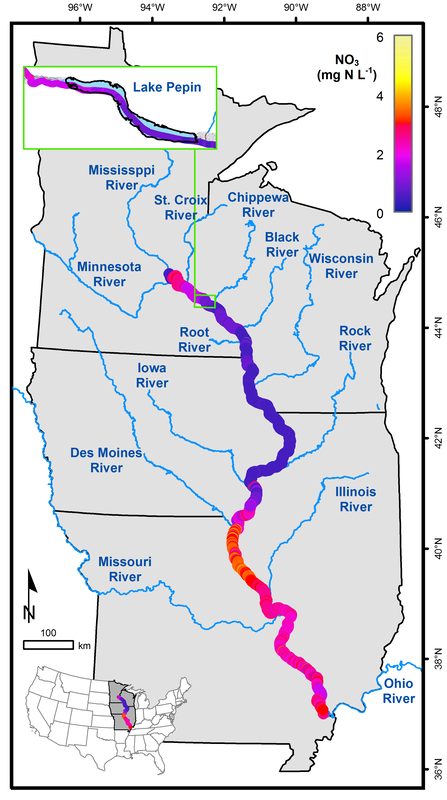
Left: Example flame dataset: Nitrate concentrations along the main stem of the Upper Mississippi River - Loken et al. 2018 Lower: FLAMe sensor box, intake, and gas equilibrator. Photo credit: Jeff Miller/University of Wisconsin-Madison 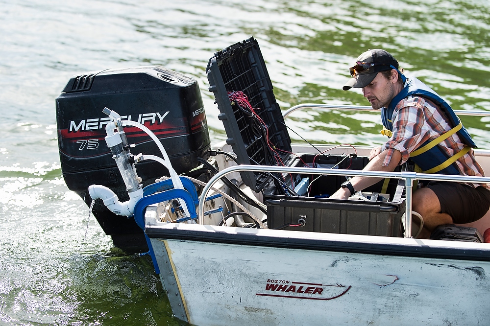
Click FLAMe to see more.
|
